Description
PIX4Dmapper – Photogrammetry Software for Drone Mapping
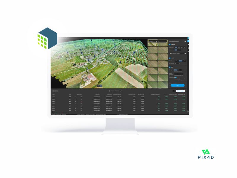
PIX4Dmapper is Pix4D's photogrammetry software for professional drone mapping. It transforms aerial and ground-level images into georeferenced maps and accurate 3D models, processing projects directly on your computer.
It supports RGB, thermal, and multispectral images from any camera or drone, as well as fisheye images, 360° camera images, and images from camera rigs and video. Its rayCloud platform links each point in the 3D reconstruction to the original images to verify and improve accuracy, and the quality report summarizes the calibration and project metrics.
Main features
- Accuracy of 1–2 GSD in X/Y and 1–3 GSD in Z, according to Pix4D.
- RGB, thermal, and multispectral images from any camera or drone.
- rayCloud environment and full project control: area of interest, control points, and editing of point clouds, MDS, meshes, and orthomosaics.
- Automatic classification of point clouds.
- Measurement of distances, areas, and volumes, and a detailed quality report.
Common applications
- Surveying and Mapping with Drones
- Construction, Engineering, and Stockpile Management
- Precision Agriculture and Heat Maps
Compatibility
Process .jpg or .tif images from any camera or drone. Export to industry-standard formats: point cloud (.las, .laz, .ply, .xyz), orthomosaics (GeoTIFF, .kml), MDS (GeoTIFF, .xyz, .las, .laz), textured 3D meshes (.ply, .fbx, .dxf, .obj, .pdf), index maps (GeoTIFF, .shp), and thermal maps (GeoTIFF).
REF: PIX001